Wanakai: Water and Health Services in a Region 1 Community
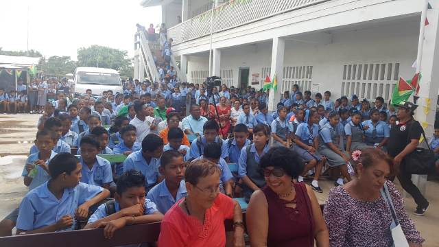
Discover Wanakai in Region 1, with a solar-powered water system reported in 2024 and a new health post in 2026.
Read more →Discover Wanakai in Region 1, with a solar-powered water system reported in 2024 and a new health post in 2026.
Read more →Meet Aruau in Region 1, with links to the Mabaruma community network and a documented local development grant.
Read more →Locate Arwansa in Moruca, Region 1, and explore its connections with the wider Santa Rosa community network.
Read more →Discover Barimanabo, also reported as Barimanobo, and its sewing centre in Region 1’s Mabaruma area.
Read more →Find Black Water Barima in the Mabaruma area, distinct from Black Water Savannah and other similarly named places.
Read more →Discover Cabora in Moruca, Region 1, through its participation in community information-technology training.
Read more →Explore Father’s Beach near the Moruca mouth, its coastal livelihoods and its place in the Shell Beach landscape.
Read more →Locate Five Star on the Barima River and follow its documented connections with Arakaka and regional education plans.
Read more →Find Kairie Island in Santa Rosa, Moruca, and explore the surrounding Region 1 communities through linked articles.
Read more →Meet Kamwatta in the Mabaruma area of Region 1, kept separate from the community of the same name in Moruca.
Read more →Discover Barima Koriabo in Region 1, with documented agricultural investment and river-based healthcare connections.
Read more →Locate Lower Kaituma in Region 1 and distinguish it from Port Kaituma through health and education records.
Read more →Discover Mora in Moruca through community computer training and transport investment, with links to neighbouring-area profiles.
Read more →Find Waicarabi-Aruka in Region 1, distinguished from Waikrebi in the Barama area by its Aruka qualifier.
Read more →Locate Unity Square in Region 1’s Mabaruma area and learn about its documented river-transport investment.
Read more →Discover Unity Grant on the Waini River and its documented school-transport connection with Warapoka.
Read more →Explore Tobago and Wauna Hill in Region 1, from a historical community description to recent services in Tobago.
Read more →Meet St. Dominic in Region 1 through its health post and documented participation in the region’s spice-growing programme.
Read more →Find St. Anselm on the Barima River, listed as St. Anslym in the directory, and learn about its river-transport connections.
Read more →Discover Seven Mile on the Moruca Branch Road in Region 1 and the water project commissioned there in 2024.
Read more →Locate Sacred Heart in Region 1 using community, health and school records, with links to surrounding places.
Read more →Meet Parakese Island in Santa Rosa, Moruca, and follow its links to Region 1’s community and cultural life.
Read more →Explore Lower Koriabo in the Mabaruma area, also written Lower Kariabo, and its connections with surrounding communities.
Read more →Discover Para in Moruca, Region 1, and the water-supply project linking its story with nearby Waramuri.
Read more →Locate Heaven Hill within Matthews Ridge, Region 1, and learn about the concrete road commissioned there in 2023.
Read more →Find Hell Hill within Matthews Ridge in Region 1, alongside the town’s other named neighbourhoods and road corridors.
Read more →Discover Minab in Matthews Ridge, Region 1, and its documented connection to the community’s expanding electricity network.
Read more →Place Garrison Hill within Matthews Ridge, Region 1, and explore the surrounding settlement through linked community profiles.
Read more →Learn about Tassiwini, listed as Tasawini in the directory, and its documented education links with Matthews Ridge.
Read more →Locate Eclipse Falls in Region 1 and follow its links with Port Kaituma, Canal Bank and Sebai.
Read more →Find Mc Doom in Port Kaituma, Region 1, distinct from the similarly named East Bank Demerara community.
Read more →Locate Thomas Hill in Mabaruma, Region 1, using regional infrastructure records and links to surrounding communities.
Read more →Explore Big Creek in Region 1 through its documented links with Falls Top and plans for a new primary school.
Read more →Locate One Mile in the Port Kaituma area of Region 1 and distinguish this settlement from other places with the same distance-based name.
Read more →Explore Citrus Grove in Port Kaituma, Region 1, where documented community projects include a meat centre and a fitness gym.
Read more →Learn about Eyelash, also written Eye Lash, in Matarkai, Region 1, and its documented development from a mining settlement.
Read more →Find Annisbisi, also called Red Hill, within Canal Bank in Region 1, and learn about its documented first public internet connection.
Read more →Discover Kinchee Creek in Region 1, a riverine community whose community centre features in the national WiFiGY connectivity programme.
Read more →Locate Red Hill along the Barima River in Region 1, distinct from Annisbisi’s Red Hill name within Canal Bank.
Read more →Explore Khan’s Hill in Region 1, listed as Khanhill in the directory, and its documented links with transport and coastal relocation.
Read more →Explore Almond Beach in Region 1’s Shell Beach Protected Area, where community life and turtle conservation meet a changing coastline.
Read more →Find Black Water Savannah in Region 1, also described as Savannah Black Water, and explore its documented community water initiatives.
Read more →Discover Three Brothers in the Waini area of Region 1, with links to community life, local production and the wider Essequibo directory.
Read more →Explore Kumaka’s waterfront and market in the Mabaruma area of Region 1, clearly distinguished from Kumaka in Moruca.
Read more →Discover Mabaruma Settlement in Region 1, including its community centre and the Banobo Guest House and bakery opened in 2025.
Read more →Locate Barasina in the Mabaruma area of Region 1, with verified references to its primary school and planned community energy improvements.
Read more →Explore Aruka Mouth in Region 1, a riverine community with documented links to fishing, farming and nearby Imbotero.
Read more →Find Four Miles in Port Kaituma, Region 1, and understand its documented links with the area’s shared water network.
Read more →Explore Fitzburg in Region 1 and its documented connections with Oronoque, Four Miles and the wider Port Kaituma area.
Read more →Locate Pakera in Region 1 using Guyana’s road gazetteer and explore its links with Matthews Ridge, Arakaka and Port Kaituma.
Read more →Explore Oronoque in Region 1’s Matarkai sub-district, its connection with Port Kaituma and a documented community meat-centre project.
Read more →Discover Powaikuru in Region 1, where creek access, farming transport and education feature in documented community developments.
Read more →Meet Hobo Hill in Region 1’s Mabaruma sub-district and learn about a documented community transport initiative.
Read more →Explore Koberimo in Barima-Waini, Region 1, including its school-feeding facilities and a multipurpose building opened in November 2026.
Read more →Locate Wanaina in Region 1 and explore its documented water-supply connection with neighbouring Wauna and the Mabaruma area.
Read more →Discover Wauna in Region 1’s Mabaruma area and its connections with Wanaina, local infrastructure and the wider north-west district.
Read more →Meet Haimaruni in Region 1’s Moruca area, where a documented youth programme supported farming, fishing, baking and small businesses.
Read more →Learn about Haimacabra in Moruca, Region 1, including documented solar power and water projects serving the community.
Read more →Explore Karaburi in Moruca, Region 1, its links with Haimaruni and the solar-energy project serving community buildings.
Read more →Discover Rincon in Moruca, Region 1, its connection with Santa Rosa and documented efforts to improve the community’s water supply.
Read more →Learn about Huridiah in Moruca, Region 1, and the school project intended to bring primary education closer to surrounding communities.
Read more →Explore Wallaba in the Moruca area of Region 1, with a documented look at its health post and links to neighbouring community profiles.
Read more →Discover Koko in Moruca, Region 1, with documented developments in community healthcare, water supply and access to education.
Read more →Find Skyland in Region 1’s community directory and learn about its documented village water project and connections with the wider Moruca area.
Read more →Explore Kamwatta in Moruca, Region 1, distinct from the Mabaruma community of the same name, with documented water and internet projects.
Read more →Canal Bank is a Region 1 community whose recent initiatives include solar power for public buildings, school transport and practical engine training.
Read more →Waikrebi is a Region 1 Indigenous village identified with the Waini district, with connections to the wider Moruca community network.
Read more →Santa Cruz, also identified with Little Kainaballi in Indigenous community records, belongs to the Moruca area of Region 1.
Read more →Chinese Landing is a Region 1 Indigenous village on the Barama River, with community institutions and links to the wider Moruca area.
Read more →Kariako is part of Region 1’s Barama River community network, with a waterfront and village projects linking transport, services and local life.
Read more →Kokerite is a Barama River village in Region 1 whose recent story includes adapting homes and community facilities to a flood-prone setting.
Read more →Assakata’s community history, farming and connections with Santa Rosa and Warapoka place it within the riverine landscape of Moruca.
Read more →Barabina is a Region 1 community whose recent public records highlight education, connectivity and its place within the Mabaruma area.
Read more →White Water is a Region 1 community whose agricultural story includes cassava cultivation, local processing and connections with the Kumaka market.
Read more →An introduction to Yarakita in the Mabaruma sub-district, including its farming connections and documented improvements to village water services.
Read more →Arukamai’s farming and transport connections link this Region 1 village with Wauna, Kamwatta, White Water and Kumaka market.
Read more →Smith Creek is a Mabaruma-area community with longstanding fishing and crab-catching livelihoods and connections to Imbotero and Morawhanna.
Read more →Hobodia, also written Hobodeia, is a Region 1 riverine community whose recent development includes a solar-powered village water system.
Read more →Hotoquai is an Indigenous village in Region 1, with agriculture and local education featuring prominently in its community story.
Read more →Bumbury Hill, often called Bumbury, is a Mabaruma-area village whose recent initiatives include sewing, craft and cultural activities.
Read more →Morawhanna, listed as Morawannah in the directory, is a North West community connected with river transport, fishing and neighbouring Smith Creek and Imbotero.
Read more →Manawarin is associated with Moruca in Region 1, while official reporting also describes a community that spans the boundary with Region 2.
Read more →Kumaka in Moruca is part of Santa Rosa’s commercial and administrative life. It is distinct from the Kumaka associated with Mabaruma.
Read more →Hosororo’s story connects Region 1 agriculture, spice processing and the long-running interest in power from Hosororo Creek.
Read more →Sebai’s boats, farming connections and community services tell part of the story of riverine life in Region 1’s Matarkai sub-district.
Read more →Discover Waramuri in Region 1’s Moruca sub-district, a village whose new secondary school also serves surrounding communities.
Read more →Explore Imbotero, a riverine community in the Barima Mora Passage where local livelihoods and mangrove conservation meet.
Read more →Meet Arakaka in the Matarkai sub-district, where community life is connected to the roads linking Port Kaituma and Matthews Ridge.
Read more →Kwabanna, also written Kwebanna, is a Moruca community whose farming traditions and cassava-processing initiatives connect it with neighbouring villages.
Read more →Warapoka is a Warrau community in Region 1’s Moruca sub-district, with homes along the Waini River and Warapoka Creek. Discover its farming traditions and community-led approach to tourism.
Read more →Santa Rosa is an Indigenous village in Moruca, within Guyana’s Barima-Waini region. Explore its community connections, educational role and relationship with the wider Moruca area.
Read more →Get to know Port Kaituma, a Region 1 community connected with the Kaituma River and the wider Matarkai area. Its hospital and sub-regional role help explain its importance beyond the settlement itself.
Read more →Matthews Ridge is a Region 1 community with a documented manganese-mining history. Explore its place in Matarkai, its community facilities and the importance of air connections to the wider country.
Read more →Discover Baramita, an Indigenous community in Region 1’s Matarkai district. This introduction explores its village identity, community institutions and connections with the wider North West.
Read more →Nestled in the northern corner of Region 1, Guyana, lies the Waini River—a winding waterway teeming with life, history, and natural wonder. As it approaches the vast Atlantic Ocean, something extraordinary happens: the two bodies of water, vastly different in character, refuse to blend easily. Instead, they form a striking, visible boundary line that seems to stretch for miles. This natural phenomenon has intrigued locals, scientists, and travelers alike, offering a breathtaking view of nature’s artistry.
Read more →Shell Beach in Guyana is indeed a stunning coastal gem! With its pristine white sand beaches, lush tropical rainforest, and abundant wildlife, it’s the perfect spot for an unforgettable vacation. The waters at Shell Beach are clear and inviting with shades of blue that complement its natural beauty. If you ever get the chance, consider visiting this hidden gem in Guyana!
Read more →The Moruca River winds its way out to the Atlantic Ocean in Region 1, Guyana, South America. A stretch of the river is so meandering that it is called “99 turns.” I’m not sure if the number of turns is exactly 99, but there are many!
Read more →There is a street in Mabaruma, Region 1, Guyana, which is dubbed “Rubber Walk” by the locals because of the beautiful, enormous, and historical rubber trees which adorn both sides of it.
Read more →