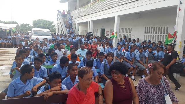
Fitzburg: A Community in the Port Kaituma Area of Region 1
Explore Fitzburg in Region 1 and its documented connections with Oronoque, Four Miles and the wider Port Kaituma area.
Read more →Your Trusted Source for All Things Guyana
Explore Fitzburg in Region 1 and its documented connections with Oronoque, Four Miles and the wider Port Kaituma area.
Read more →Learn about Haimacabra in Moruca, Region 1, including documented solar power and water projects serving the community.
Read more →Explore Karaburi in Moruca, Region 1, its links with Haimaruni and the solar-energy project serving community buildings.
Read more →Meet Haimaruni in Region 1’s Moruca area, where a documented youth programme supported farming, fishing, baking and small businesses.
Read more →Discover Rincon in Moruca, Region 1, its connection with Santa Rosa and documented efforts to improve the community’s water supply.
Read more →Learn about Huridiah in Moruca, Region 1, and the school project intended to bring primary education closer to surrounding communities.
Read more →Explore Wallaba in the Moruca area of Region 1, with a documented look at its health post and links to neighbouring community profiles.
Read more →Discover Koko in Moruca, Region 1, with documented developments in community healthcare, water supply and access to education.
Read more →Find Skyland in Region 1’s community directory and learn about its documented village water project and connections with the wider Moruca area.
Read more →Explore Kamwatta in Moruca, Region 1, distinct from the Mabaruma community of the same name, with documented water and internet projects.
Read more →Assakata’s community history, farming and connections with Santa Rosa and Warapoka place it within the riverine landscape of Moruca.
Read more →Kokerite is a Barama River village in Region 1 whose recent story includes adapting homes and community facilities to a flood-prone setting.
Read more →Kariako is part of Region 1’s Barama River community network, with a waterfront and village projects linking transport, services and local life.
Read more →Chinese Landing is a Region 1 Indigenous village on the Barama River, with community institutions and links to the wider Moruca area.
Read more →Santa Cruz, also identified with Little Kainaballi in Indigenous community records, belongs to the Moruca area of Region 1.
Read more →Waikrebi is a Region 1 Indigenous village identified with the Waini district, with connections to the wider Moruca community network.
Read more →Canal Bank is a Region 1 community whose recent initiatives include solar power for public buildings, school transport and practical engine training.
Read more →White Water is a Region 1 community whose agricultural story includes cassava cultivation, local processing and connections with the Kumaka market.
Read more →An introduction to Yarakita in the Mabaruma sub-district, including its farming connections and documented improvements to village water services.
Read more →Arukamai’s farming and transport connections link this Region 1 village with Wauna, Kamwatta, White Water and Kumaka market.
Read more →Smith Creek is a Mabaruma-area community with longstanding fishing and crab-catching livelihoods and connections to Imbotero and Morawhanna.
Read more →Morawhanna, listed as Morawannah in the directory, is a North West community connected with river transport, fishing and neighbouring Smith Creek and Imbotero.
Read more →Hobodia, also written Hobodeia, is a Region 1 riverine community whose recent development includes a solar-powered village water system.
Read more →Hotoquai is an Indigenous village in Region 1, with agriculture and local education featuring prominently in its community story.
Read more →Bumbury Hill, often called Bumbury, is a Mabaruma-area village whose recent initiatives include sewing, craft and cultural activities.
Read more →Barabina is a Region 1 community whose recent public records highlight education, connectivity and its place within the Mabaruma area.
Read more →Discover Waramuri in Region 1’s Moruca sub-district, a village whose new secondary school also serves surrounding communities.
Read more →Sebai’s boats, farming connections and community services tell part of the story of riverine life in Region 1’s Matarkai sub-district.
Read more →Hosororo’s story connects Region 1 agriculture, spice processing and the long-running interest in power from Hosororo Creek.
Read more →Kumaka in Moruca is part of Santa Rosa’s commercial and administrative life. It is distinct from the Kumaka associated with Mabaruma.
Read more →Manawarin is associated with Moruca in Region 1, while official reporting also describes a community that spans the boundary with Region 2.
Read more →Meet Arakaka in the Matarkai sub-district, where community life is connected to the roads linking Port Kaituma and Matthews Ridge.
Read more →Kwabanna, also written Kwebanna, is a Moruca community whose farming traditions and cassava-processing initiatives connect it with neighbouring villages.
Read more →Explore Imbotero, a riverine community in the Barima Mora Passage where local livelihoods and mangrove conservation meet.
Read more →Discover Baramita, an Indigenous community in Region 1’s Matarkai district. This introduction explores its village identity, community institutions and connections with the wider North West.
Read more →Matthews Ridge is a Region 1 community with a documented manganese-mining history. Explore its place in Matarkai, its community facilities and the importance of air connections to the wider country.
Read more →Get to know Port Kaituma, a Region 1 community connected with the Kaituma River and the wider Matarkai area. Its hospital and sub-regional role help explain its importance beyond the settlement itself.
Read more →Santa Rosa is an Indigenous village in Moruca, within Guyana’s Barima-Waini region. Explore its community connections, educational role and relationship with the wider Moruca area.
Read more →Warapoka is a Warrau community in Region 1’s Moruca sub-district, with homes along the Waini River and Warapoka Creek. Discover its farming traditions and community-led approach to tourism.
Read more →The Marudi Mountains in the Deep South of Region 9 is a designated gold mining area in Guyana that has been in operation for decades. Thousands of Guyanese, especially residents of Region 9, have earned a living in the Marudi Mountains. But all that glitters is not gold, and the Marudi Mountains gold mining area does have its downside. This article explains.
Read more →Nestled in the heart of the Guiana Shield lies Mount Roraima, a majestic flat-topped mountain that forms the tri-border point of Guyana, Venezuela, and Brazil. Rising to a staggering 2,810 meters (9,219 feet) above sea level, this ancient tepui has captivated explorers, scientists, and dreamers for centuries. But here’s a secret many don’t know: while Venezuela claims the lion’s share of visitors to Mount Roraima, the Guyana side of the mountain offers an equally breathtaking and unique perspective waiting to be discovered.
Read more →The serene beauty of the Cuyuni River, separating Guyana and Venezuela, has long been a source of connection and cultural exchange for the communities on both sides. From the Venezuelan village of San Martin, where the photo abvoe was taken, the tranquil river mirrors the soft hues of the sky, while across the water lies Eteringbang, a modest yet vibrant settlement in Guyana.
Read more →Nestled in the northern corner of Region 1, Guyana, lies the Waini River—a winding waterway teeming with life, history, and natural wonder. As it approaches the vast Atlantic Ocean, something extraordinary happens: the two bodies of water, vastly different in character, refuse to blend easily. Instead, they form a striking, visible boundary line that seems to stretch for miles. This natural phenomenon has intrigued locals, scientists, and travelers alike, offering a breathtaking view of nature’s artistry.
Read more →The meeting of two rivers, as captured in this stunning image of the Kamarang and Mazaruni rivers in Region 7, Guyana, South America tells a story as old as time itself—a tale of contrast, unity, and the wonders of nature. The rivers, each carrying the essence of their journey, flow side by side without immediately blending. One is dark and dense, rich with minerals, sediment, or organic matter collected through forests and wetlands. The other is lighter, or murky in color, perhaps carrying a different mineral composition or polluted by mining operations upstream. Their stark division speaks of the unique qualities of each river and is a gentle reminder of the mysterious forces that shape the natural world.
Read more →Located in the North Rupununi region of Guyana’s Region 9, Rewa Village is an enchanting place known for its unspoiled natural beauty, rich biodiversity, and the sustainable tourism model pioneered by its Rewa Eco Lodge.
Read more →Is it a bit too hot and noisy where you live in Guyana. It’s probably because you picked the wrong place to live! Why not take a walk to Kato Village in Region 8? This mountaintop paradise will take your breath away.
Read more →The Pomeroon River in Guyana is a lesser-known but magnificent waterway that flows through a rich landscape of culture, history, and biodiversity. Stretching about 104 kilometers (65 miles), it runs between the Essequibo and Orinoco rivers in the Pomeroon-Supenaam Region. Unlike many of the country’s major rivers, the Pomeroon empties into the Atlantic Ocean to the northwest, rather than the northeast, adding a unique characteristic to its geography.
Read more →Have you ever visited Yupukari Village? Immerse yourself in a distant land full of natural wonders. Yupukari Village is located in the Central Rupununi Savannahs of Guyana. Here’s the story.
Read more →Shell Beach in Guyana is indeed a stunning coastal gem! With its pristine white sand beaches, lush tropical rainforest, and abundant wildlife, it’s the perfect spot for an unforgettable vacation. The waters at Shell Beach are clear and inviting with shades of blue that complement its natural beauty. If you ever get the chance, consider visiting this hidden gem in Guyana!
Read more →Giant anthills are found in many places across Guyana, but in Termite City, there is a remarkably high concentration of them!
Read more →The Moruca River winds its way out to the Atlantic Ocean in Region 1, Guyana, South America. A stretch of the river is so meandering that it is called “99 turns.” I’m not sure if the number of turns is exactly 99, but there are many!
Read more →One of the few things that Guyanese sometimes complain about is the heat. Guyana is a generally hot country most of the time. But it’s really not that bad. Some people would say that Guyana has beautiful climate. But it gets even better! There is a place in Guyana where the temperature ranges from 15 to 8 degrees Celsius!
Read more →12th of December, 2023. Guyana, South America. GSA News. Guyana News. Understanding why Venezuelans think that the Essequibo belongs to them gives one a good insight into why some of them are so determined to fight for it. Nevertheless, as UK Foreign Secretary, David Cameron, said, “those borders were settled in 1899.” Despite the fact
Read more →On Sunday, 3rd of December, 2023, dictator president of Venezuela, Nicolas Maduro, held a referendum which sought the approval of the Venezuelan people to annex the Essequibo territory and make it part of Venezuela – by force and without consultation with, or the approval of, the Guyana Government. According to the National Electorate Council of Venezuela, over 10 million voters turned up to the polls and over 95% voted yes to all five of the following questions:
Read more →There’s just about three days left before Venezuela’s 3rd of December referendum which seeks to ratify the support of the Venezuelan people for forcefully annexing the Essequibo county of Guyana and making it into a new state within the country of Venezuela. While the Guyana Government has petitioned the ICJ to issue a ruling that confirms the illegality of such a move, and the court is scheduled to do so on Friday, December, 1, 2023, president of Venezuela, Nicolas Maduro, has said that that won’t stop him from flooding the Essequibo with Venezuelan soldiers and civilians and demarcating new boundaries for Venezuela after the referendum.
Read more →Among other questions, all of which are intended to further Venezuela’s unlawful and unfounded claim to more than two-thirds of Guyana’s national territory, question five is the most pernicious: it brazenly seeks the approval of the Venezuelan people of the creation of a new Venezuelan State consisting of Guyana’s Essequibo Region, which would be incorporated into the national territory of Venezuela, and the granting of Venezuelan citizenship to the population.
Read more →While the tyrannical Maduro dictatorship regime and its media cheerleaders are beating the drums of war, the question arises: is this a complete act of bullyism or does Venezuela really have a legitimate claim to the Essequibo? From a patriotic standpoint, I’d say, “No. Venezuela has no claim to the Essequibo.” However, from a neutral standpoint, I’d have to admit that it does.
Read more →Mount Roraima is shared this way: 5% Brazil, 30% Guyana and 65% Venezuela. It’s 2700 meters makes it the highest elevation to Guyana, but not the highest to Brazil and Venezuela. Brazil’s higest mount is 2.900 meters and Venezuela highest is 4.970 meters–the tops of which has snow and ice.
Read more →The Denham Suspension Bridge is located at Mahdia, Region 8, Guyana, South America. At the time of first publication of this article, the Denham Suspension Bridge, a British architectural marvel, is 90 years old and still standing strong. The Denham suspension bridge was constructed in the year 1933 during British colonial rule of then British Guiana.
Read more →The town of Mahdia is located in the Potaro-Siparun Region, also called Region 8, of Guyana, South America. It serves as the capital and main commercial center of Region 8. Located at an altitude of 415 meters, Mahdia is geographically located near to the center of Guyana at latitude 5.2667 and longitude -59.1500.
Read more →The International Court of Justice has issued a Press Release today, 3rd of April, 2023 that it will rule on the 6th of April, 2023 on the Guyana/Venezuela Border Controversary. The ruling, which is likely to be in favor of Guyana, who is the rightly owner of the territory, will test Caracas’ resolve to bully this territory from Guyana.
Read more →The purpose of the video was to give a glimpse of what it looks like to cross over from Brazil into Guyana. But it did a little more than raise a few eyebrows: it raised a very serious question: are there security checks for persons traveling between Guyana and Brazil at Region 9? The answer is both yes and no. And I’ll explain.
Read more →There is a street in Mabaruma, Region 1, Guyana, which is dubbed “Rubber Walk” by the locals because of the beautiful, enormous, and historical rubber trees which adorn both sides of it.
Read more →St Ignatius Village is a Titled Indigenous Village in Region 9 of Guyana, South America. The village, which borders the town of Lethem, is replete with breathtaking scenery, beautiful landscapes, and natural vegetation. The bridge which crosses over the Moco Moco Creek marks the entry point into St Ignatius Village from Lethem. This bridge is located only about 120 m southwest of the Lethem airport.
Read more →The actions of two Guyanese men on a dangerous cliff of a waterfall in Region 7, Guyana, South America, has caught the world’s attention. The video, which was first posted in 2018 by Leon Mendonca, and reposted by the Guyana, South America Facebook Page in 2022, was viewed by more 800,000 people so far, and it is going viral.
Read more →The Rupununi Savannahs of Guyana, South America is located in the county of Essequibo in Region 9. The entire Region 9 of Guyana is referred to as the Rupununi Savannahs. It includes the North, South, and Central Rupununi Savannahs. The Kanuku Mountain Range divides the North from the South Rupununi Savannahs.
Read more →I’ve previously published an article giving general, touristic, and business information on the Town of Lethem. Because people are often concerned with their safety when traveling from place to place, they often ask questions about criminal activities and violence in that area. For this reason, I’ve decided to create a non-exhaustive log of criminal activities and violence in Lethem that I’m aware of.
Read more →The Iworkrama Forest Reserve consists of 31,700 hectares of tropical rainforest in Guyana, South America. The Iwokrama Forest Reserve is managed by the Iwokrama International Center for Rainforest Conservation and Development.
Read more →Region 7, also called the Cuyuni-Mazaruni Region, is one of Guyana’s ten administrative regions. It is bordered by Venezuela to the east and the Essequibo River to the west. Covering an area of 18,400 square miles or 47,650 square kilometers, the Cuyuni-Mazaruni Region is bigger than the Netherlands.
Read more →Region 8 is one of Guyana’s ten Administrative Regions. It is also called the Potaro-Siparuni Region. Region 8 borders Region 7 to the north, Regions 10 and 6 to the east, Region 9 to the South, and Brazil to the west.
Read more →Saxacalli Village is located on the west bank of the Essequibo River some 25 miles (40 km) south of Parika at 6°35′N 58°37′W Coordinates: 6°35′N 58°37′W, in Guyana, South America. It was originally an Arawak community. Its present population of about 250 reflects Guyana’s multi-ethnicity.
Read more →It is possible for Guyanese to cross over into the Brazilian town of Normandy from Karasaibai Village in the South Pakaraima/North Rupununi District of Guyana, South America. The border between Normandy, Brazil and Karasabai, Guyana is formed by the Ireng River and is usually crossed by boats.
Read more →Known for its beautiful mountains and breathtaking scenery, Karasabai Village lies peacefully beneath the shade of the majestic Pakaraima Mountains in the South Pakaraimas District of Region 9 in Guyana, South America.
Read more →Shulinab is an Indigenous village located in South Central Rupununi, Upper Takutu-Upper Essequibo, Region Nine, Guyana, South America. The village was named after a palm tree called Shaorai. It is situated between the right bank of Sawariwao river and to the left bank of Sawarab creek. It is bordered to the eastern and northern boundaries by the Kanuku mountains.
Read more →The Takutu River flows from between Roraima, Brazil and Region 9, Guyana. It forms a river border between Guyana and Brazil for several miles at Region 9 of Guyana, South America. For Brazilians, the name of the Takutu River is “Rio Tacutu.”
Read more →The Lethem to Linden Trail is a 300 miles (approximately) trail cut mostly through the Amazon Rain Forest from Lethem to Linden. The Lethem-Linden Trail is also referred to as the “Lethem – Georgetown Trail.” That’s because there is paved road from Linden going to Georgetown, while from Lethem to Linden, it’s a sand/brick/clay trail.
Read more →Hundreds of miles south of the town of Lethem, a small community of Indigenous People live peacefully and happily. In the heart of the Amazon Rainforest, in the Deep South Rupununi Savannahs of Guyana, South America, at the headwaters of the mighty Essequibo River, is tucked away this beautiful piece of paradise – Masakanari Village, also known as Gunns Village.
Read more →As the Venezuelan people and government continue their ramblings over Guyana’s Essequibo territory, the Guyanese people are firmly resolved to holding their ground with their unified and resounding “not one blade of grass” song to the Venezuelans. But a 90-year-old Venezuelan stamp restates what we as Guyanese have known all along – that the Essequibo was never part of Venezuela, and that Caracas was never keen on claiming the Essequibo prior the 2015 oil discovery in Guyana’s waters.
Read more →Maruranau is a piece of natural paradise tucked away at the edge of the Amazon Rainforest, in the South Rupununi Savannas of Guyana, South America. You can get there by traveling first to Lethem, and then traveling south of Lethem for 4 hours by bus.
Read more →The Kurupukari Crossing is located along the Lethem – Georgetown Trail, about 5 hours’ drive from Lethem, and about 8 hours when you’re coming from Georgetown. There is where the Essequibo River cuts the trail into two parts. There is a boat service which ferries vehicles across the Essequibo River every hour of the day. This is called the Kurupukari Crossing.
Read more →The Takutu River Bridge was completed in the year 2009 as part of an initiative between the governments of Guyana and Brazil. Since then, travel between the two countries has been very much streamlined, and so has cultural exchange.
Read more →Bartica, one of Guyana’s most beautiful towns, is located in Region 7, also called the Cuyuni-Mazaruni Region of Guyana, South America. where the Cuyuni and Mazaruni Rivers merge with the Essequibo River. The population of Bartica is approximately 20,000, and the main economic activity of the residents of Bartica is gold mining.
Read more →Have you ever visited Paruima Village in Region 7? This article explores the beauty and splendor of this remote indigenous settlement.
Read more →The town of Lethem is located in the county of Essequibo, Region No. 9, in the country of Guyana, South America. At the time of this writing, Lethem is officially a town, having been granted township in 2016 by the past APNU/AFC government, which ruled Guyana from 2015 to 2020, in fulfillment of a promise made during the 2015 elections campaigning.
Read more →It’s an approximate 30 minutes drive by car from Lethem. The new Guest House is quite impressive as well and is up and running with 2 rooms available with a capacity of 4 persons person room. The cost for locals is only $5500 a night! Where can you get a better deal??? There’s water, electricity and INTERNET 24/7!
Read more →Karawab is a satellite of St. Monica Village located on the Eastern Bank of the Upper Pomeroon River, 40 miles from Charity on the Essequibo Coast in Region 2 of Guyana, South America. Karawab, an Amerindian community was formally recognized in 1970. It is one of the most populated villages in the Upper Pomeroon river with an estimated 800 Caribs. The Village is led by Senior Councillor who reports to the Toshao and his deputy based in St. Monica.
Read more →Patrick Carpen recalls a 2016 visit to Sand Creek Secondary School with students from St. Ignatius. The journey introduces the Rupununi landscape and the welcoming people of Sand Creek.
Read more →The county of Essequibo encompasses approximately 290,000 people in 700 villages and communities, the majestic Kaieteur Falls – the world’s highest single-drop waterfall – and most of Guyana’s precious mineral resources to boot. This includes the Rupununi Savannahs which span thousands of acres of virtually untouched plains, rain-forested mountains, Amerindian villages and rare wildlife–one of the brightest jewels in Guyana’s tourism crown. The Essequibo is everything west of the mighty Essequibo River towards the border with Venezuela.
Read more →